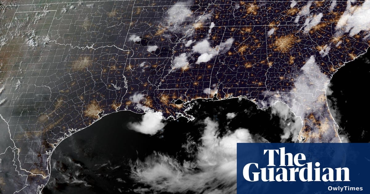

Why do we still treat unpredictable natural systems like predictable software rollouts, expecting linear progress when nature operates on its own erratic algorithm? As Tropical Storm Bertha crawls through the Gulf of Mexico, it is behaving less like a streamlined, high-velocity threat and more like a buggy, slow-rolling operating system update that keeps shifting its deployment schedule. The real story here isn’t the raw wind speed of this brewing storm—it’s how a sluggish, data-defying system is exposing the limits of our predictive infrastructure, forcing coastal communities to scramble as the forecast models rewrite themselves in real-time. For everyday citizens along the Gulf Coast, this isn't just a meteorological event; it is a stark reminder of how vulnerable our highly optimized, modern lives remain to analog disruptions.
A Slow-Motion System Defying the Predictive Models
In the tech world, we dread the "slow roll"—an update that lingers in beta, threatening to break local systems without ever fully delivering. According to the BBC, Bertha is moving northwest at an agonizingly slow 3 mph, a crawling pace that gives the storm ample time to absorb warm Gulf waters and complicate evacuation math. By early Tuesday morning, that crawl had slowed even further to a mere 2 mph, according to CBS News, which reported on the updated advisory issued at 2 a.m. EDT on July 21, 2026. This glacial velocity is precisely what makes the storm so dangerous; like a background process hogging system memory, a slow-moving storm dumps unprecedented amounts of water on a concentrated area. The Miami-based National Hurricane Center (NHC) warned that this sluggish system could drop 2-4 inches of rain, with isolated pockets seeing up to 8 inches through Friday, triggering severe flash flooding in urban areas.
Shifting Coordinates and the Struggle for Data Consensus
When independent data pipelines conflict, it highlights the inherent chaos of predictive modeling. For instance, on Monday evening, The Guardian reported that the center of Bertha was located about 110 miles south of Panama City, Florida, carrying maximum sustained winds of 40 mph. However, the BBC placed the storm slightly closer at 105 miles south of the same city at roughly the same time. These minor discrepancies in telemetry quickly escalated as the storm began to rapidly optimize its intensity. By early Tuesday, CBS News reported that Bertha's sustained winds had spiked to 50 mph, a significant jump from the 40 mph recorded just three hours prior. Meanwhile, far to the west in the eastern Pacific, a completely separate system named Hurricane Fausto had rapidly scaled up to hurricane status with 75 mph winds, though The Guardian noted it remained 745 miles southwest of Baja California and posed no immediate threat to land.
Escalating Warnings and the Reality of Hardcoded Infrastructure
This rapid shift in storm intensity triggered an immediate upgrade in the region's alert status, transitioning from passive "watches" to active "warnings." While The Guardian initially detailed a tropical storm watch stretching from the Mississippi-Alabama border to the Louisiana border, CBS News later confirmed that a full Tropical Storm Warning had been established from the Alabama-Florida border to the Jefferson-Plaquemines Parish border in Louisiana. A storm surge watch remains active across this same stretch, with water levels projected to rise by 2-4 feet from the mouth of the Mississippi River to the Alabama-Florida border, and 1-3 feet in other coastal areas like Lake Pontchartrain. This is only the second named storm of the 2026 season, following Tropical Storm Arthur, though even Arthur's legacy is subject to differing historical records. The Guardian reported that Arthur brought heavy rain to the southeastern United States last month, whereas CBS News noted that Arthur actually made landfall in June along the Gulf Coast of Texas.
Low-Tech Defenses for a High-Tech Forecasting Dilemma
No matter how sophisticated our satellite imagery or predictive AI models become, the physical interface of our cities remains stubbornly analog. In New Orleans, Louisiana, where Bertha is projected to make landfall by Wednesday, the defense strategy relies on sandbags and manually clearing local storm drains rather than digital solutions, as reported by the BBC. This juxtaposition is the ultimate reality check for the tech-optimist crowd: when the cloud fails, you need a shovel. For the ordinary user living in the path of the storm, the immediate concern isn't the elegant code of a weather app, but whether their local infrastructure can handle the physical load.
What happens next will be decided by whether the storm's physical structure can survive its projected transition back into a tropical depression on Thursday as it edges closer to the Texas coast. If the current atmospheric resistance holds, expect Bertha to fully dissipate by the end of the week, but not before delivering a costly, real-world stress test to the Gulf's physical infrastructure. The ultimate metric of success won't be found in the NHC's digital tracking maps, but in whether New Orleans' cleared drains can handle the sudden influx of water.