
Why are we so obsessed with digitizing the future when we haven't even finished cataloging the past? We treat modern data centers like monoliths of progress, yet here in Sheffield, a piece of medieval infrastructure is proving that "cloud storage" is a concept that started with literal stone and water.
The real story here isn’t just about digging up old rocks—it’s about how we are using 21st-century robotics to solve the "black box" problem of history. By deploying a drone protected by a metal cage into the depths of a fortress well, researchers are effectively performing a remote server migration for a site that hasn't seen light since the 17th century.
The Engineering of Survival
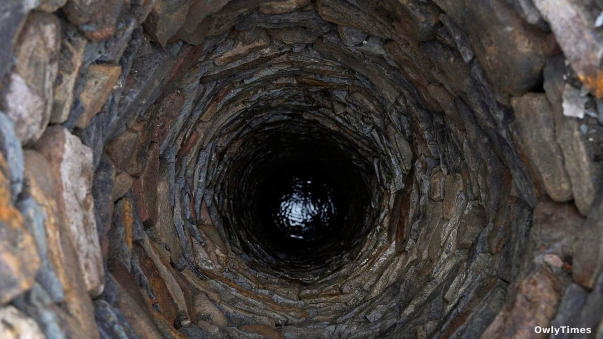
Wessex Archaeology, working alongside FlyThru, recently completed a survey of a medieval well located beneath the site of Sheffield Castle. This isn't just an archaeological curiosity; it’s a masterclass in resilient infrastructure. The well, which sits inside the Norman motte, was the primary lifeline for a fortress that stood near the confluence of the Rivers Don and Sheaf.
Ashley Tuck, Research Manager at Wessex Archaeology, notes that this water source was non-negotiable for anyone living inside the walls, particularly during the English Civil War in the 1640s. When Parliamentarian forces laid siege to the castle, the difference between surrender and survival was quite literally what was at the bottom of that shaft. For the inhabitants, the well was the ultimate "high availability" system; if the connection to the outside world was severed, the internal network had to hold.
Building a Digital Twin of the Middle Ages
The team recorded the shaft at approximately 12.5 meters deep, utilizing drone technology to capture hundreds of photographs. These images were then synthesized into a detailed 3D model of the interior, effectively creating a "digital twin" of a structure built soon after the Norman Conquest.
This approach serves as a stark reminder of how we approach technical debt. By using drones to map the well, archaeologists avoided the physical degradation that comes with traditional excavation. They captured the construction details of the stone lining and the bedrock transition without disturbing the fragile remains. It is a form of archival preservation that ensures the data remains accessible long after the physical site is exposed as part of Sheffield City Council’s Castlegate Regeneration Project.
Mapping the Future of Urban Spaces
It is easy to look at the ruins of a dismantled castle and see only debris, but the ongoing work beneath the modern city center is revealing a complex, interconnected urban core. While the castle was a center of power for centuries, its true value now lies in the granular data it provides about daily life.
The project aims to transform the historic Castlegate district into a public green space, with plans to make the well visible to the public. We are moving toward a future where our city centers are hybrid environments, layering modern public parks over the literal foundations of our history. The next readings of the site’s structural stability and environmental data as the area is cleared for public access will indicate whether this high-tech preservation strategy can successfully bridge the gap between ancient necessity and modern urban planning.