
The urgency surrounding sea level rise is often framed as a distant threat, a problem for future generations. But a new study published Wednesday in Nature reveals a critical, and deeply unsettling, reality: we’ve been significantly underestimating the problem all along. The research, led by Katharina Seeger of the University of Padua in Italy, isn’t predicting a faster rate of sea level rise – it’s demonstrating that the baseline from which we measure that rise is fundamentally flawed, meaning the impacts will be felt by far more people, and on far more land, than previously understood. This isn’t about a change in climate models; it’s about a correction to the very foundation of those models, a “methodological blind spot” as described by study co-author Philip Minderhoud of Wageningen University & Research in the Netherlands.
The core of the issue lies in how we measure altitude. Traditionally, sea level rise calculations begin with a theoretical “zero meter” point – an idealized, still ocean surface. However, the real ocean is never still. It’s dynamic, constantly shifting with waves, tides, currents, and even temperature fluctuations. The study meticulously reviewed hundreds of existing scientific studies and hazard assessments, finding that approximately 90% underestimated baseline coastal water heights by an average of 1 foot (30 centimeters). While a foot may not sound substantial, the cumulative effect is enormous. In regions like the Indo-Pacific, the discrepancy can reach nearly 3 feet (1 meter), dramatically altering projections of inundation.
This isn’t a uniform error. The study highlights a stark geographical disparity, with the Global South, the Pacific, and Southeast Asia disproportionately affected. Europe and Atlantic coasts show comparatively smaller discrepancies. This unevenness isn’t accidental; it’s a consequence of the techniques used to measure land and sea elevation. Land-based measurements, like those from GPS, are highly accurate, but satellite measurements of sea level often struggle to account for the complex, localized factors influencing coastal water heights. As Ben Strauss, CEO of Climate Central, explains, “To understand how much higher a piece of land is than the water, you need to know the land elevation and the water elevation. And what this paper says the vast majority of studies have done is to just assume that zero in your land elevation dataset is the level of the water. When in fact, it's not.”
Based on the original PBS report.
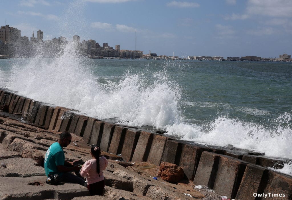
The implications of this revised baseline are profound. If sea levels rise by just over 3 feet (1 meter) – a scenario many studies predict by the end of the century – the study estimates that up to 37% more land could be inundated, threatening an additional 77 to 132 million people. This isn’t simply a matter of redrawing maps; it’s about the displacement of communities, the loss of livelihoods, and the exacerbation of existing inequalities. Anders Levermann, a climate scientist at the Potsdam Institute for Climate Impacts Research in Germany, emphasizes the human cost: “You have a lot of people here for whom the risk of extreme flooding is much higher than people thought.” The reality is already visible for 17-year-old climate activist Vepaiamele Trief in Vanuatu, where shorelines are receding, beaches are eroding, and homes are increasingly vulnerable. “These studies, they aren't just words on a paper,” she states, “They're people's actual livelihoods.”
However, the study’s findings aren’t universally accepted. Some scientists, like Gonéri Le Cozannet of the French geological survey, suggest the implications are overstated, arguing that the problem is already understood and accounted for in local planning. While acknowledging that some regions, like Vietnam, have accurate elevation data, Minderhoud counters that this isn’t the norm, particularly in vulnerable island nations. This debate underscores a critical tension: the gap between global modeling and localized realities. It also arrives alongside a new UNESCO report highlighting significant uncertainties in our understanding of the ocean’s carbon sink capacity, with models differing by 10-20% – further complicating global climate projections.
This confluence of findings – the underestimated sea level baseline and the uncertain carbon sink – paints a concerning picture of incomplete knowledge. The next crucial research step isn’t simply refining sea level rise projections, but developing standardized, localized methods for accurately measuring coastal water heights. This requires integrating high-resolution satellite data with on-the-ground measurements, and crucially, prioritizing data collection in the regions most vulnerable to the impacts. We need to move beyond theoretical models and focus on understanding the specific, dynamic conditions at the intersection of land and sea. The question now isn’t if sea levels will rise, but how much more land and how many more lives are at risk because of a fundamental error in how we’ve been measuring the problem. And, critically, what proactive steps will be taken to protect those communities before the revised projections become their lived reality?